 Research Activities Research Activities
Sustaining Marine Technology Partnerships — a concept for an Operational
Repository of Coastal Hydraulics & Inlet Dynamics was developed with NC
State University. This effort was presented at the "Oceans '99" MTS Conference. Several 2D & 3D
requirement databases have been built for the Department of the Navy.
Formal Publications — a 100,000-word oceanography
reference book for a general readership and 600-entry encyclopedia of marine
science.
Sustaining Marine Technology Partnerships — Principles
common to successful marine technology partnerships were described in a desktop
study for the Marine Advanced Technology
Education (MATE) Center. As a procedural test, MIRC is helping to turn the
Bay Bus Partnership Project (B2P2) into a 501(c) 3 not-for-profit corporation
to benefit Maryland students.
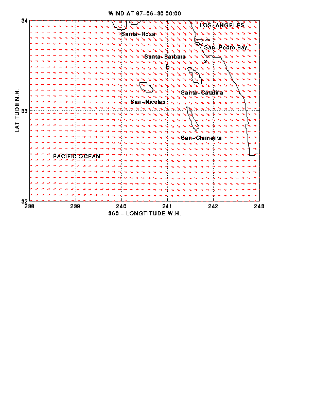
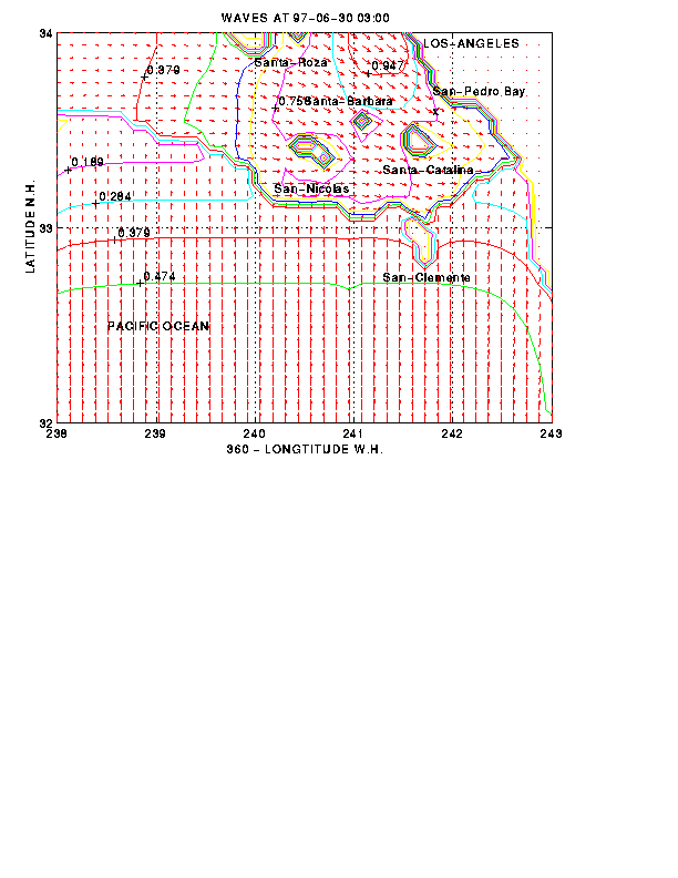
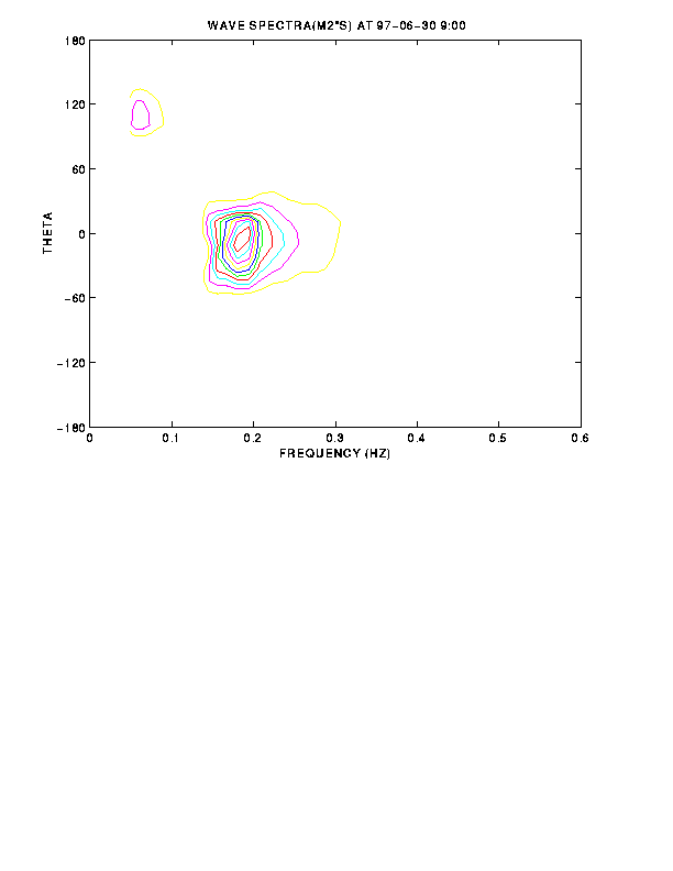
Wave Modeling — Continued advances in shallow water (SW)
wave modeling serve to improve navigation and help save lives and property. An
existing 3rd generation wave model is being applied to calculate accurate
wave height, wave period, and wave direction using a Pentium processor.
Inputs include bathymetry, surface winds, currents,
and swell. Customized graphs include wave
parameters and spectra that are applied to benefit commercial and military
users. Complete model descriptions and applications guidance are being
developed by Dr. Valeri Kalmykov.
Sea Ice Analyses — Quality Control of polar data that
includes application of automated and manual procedures is being accomplished
for various customers.
Geospatial Display of High Resolution Data — Studying data
types and manipulating existing products with CRMS and NGA to rapidly display
littoral information.
On the web since April 05, 1999.
|